Friday, July 22, 2011

Extreme Weather Sweeping the US

It's everywhere. Roads buckling from the heat in Minnesota, cattle dying by the thousands in South Dakota, and crowds of sweaty commuters crowded around the slightest hint of an air conditioned breeze on the DC metro. This heat wave, along with droughts in Texas, wildfires in Arizona, floods in the Midwest, and tornadoes in the South, have got everybody thinking about extreme weather events and their possible connection to climate change.

To confirm the facts and dispel the myths, the head of the Climate and Energy Program at the World Resources Institute will be holding a live Q & A on the Washington Post's website today. This will be followed by an editorial piece, "5 Myths about Extreme Weather" in the paper this weekend. Make sure to check it out.

Thursday, June 30, 2011

Debates over Hydraulic Fracturing

natural gas drilling
Photo courtesy of Helen Slottje for www.shaleshock.org

The use of hydraulic fracturing to exploit unconventional sources of natural gas is perhaps the most  divisive new development in domestic energy technology this decade. Hydrofracking, or "fracking" as it is commonly called, is the process by which pressurized fluid intrudes into a rock formation, resulting in the fracture of bedrock. Increasingly, this technique is used in natural gas extraction where pressurized water, chemicals, and propping agents are injected into a wellbore in order to induce and maintain fractures at-depth in gas-bearing formations. This technology has recently allowed the profitable exploitation of “unconventional” natural gas deposits, which includes shales, coalbeds, and tight sands (EPA, 2011).  

The potential energy resources of unconventional gas deposits are predicted to be significant (comprising up to 60% of onshore gas resources), and in the United States may end up providing an alternative to imported fossil fuels and “dirtier” energy sources such as coal (DOE, 2009). Recent estimates by the Energy Information Administration predict over 2,552 trillion cubic feet of recoverable natural gas in the U.S., enough to supply the nation for 110 years at current rates of production (EIA, 2010). The largest reservoirs of the newly available gas are stored in shale basins spread across the eastern, southern, and central U.S. This includes the Barnett formation in Texas, the Fayetteville formation in Arkansas and Oklahoma, and the Marcellus formation, which extends from Tennessee up through New York. Natural gas exploration and production in these regions has increased exponentially over the last few years. In the U.S. in 2008, the number of natural gas and condensate wells increased 5.7%, reaching an historic peak of 478,562 wells (Kargbo et al., 2010).

Those wells which employ hydraulic fracturing, however, are increasingly coming under scrutiny as new concerns have emerged about the environmental and health impacts of this new technique. A single HF operation can require millions of gallons of hydraulic fracturing fluid- a mixture of water, a proppant such as sand or ceramic beads, and up to 750 chemicals and other components. A recent Congressional investigation determined that between 2005 and 2009, HF operations used at least 29 chemicals that are either human carcinogens (such as benzene and lead), regulated under the Safe Drinking Water Act, or regulated under the Clean Air Act (U.S. House of Representatives, 2011). There is widespread public concern about the threat to drinking water safety, as well as concern that the oil and gas service companies and regulatory agencies are not aware of the full range of dangers or even the ingredients in HF fluid (Urbina, 2011). To assess the exact risk to drinking water resources, the EPA has recently initiated a study of the full lifecycle of HF production (EPA, 2011).

Widespread public resistance to hydraulic fracturing has taken on a number of forms, from popular documentaries ("Gasland") to regular and solicitous articles in the New York Times. Bus stops ads in Manhattan show a vacationer tubing on a lake wearing a silver hazmat suit. Concerned community groups have rallied in rural areas where drilling has been extensive. Counter-point arguments come forth from industry executives, but not many other sources.

So, is the drilling actually harmful? I attended a seminar on this subject at this year's annual meeting of the American Academy for the Advancement of Science. Geologists, engineers, and sociologists contributed to what was probably the most heated debate at an otherwise sedate conference. While some believed the drilling to be harmful and others insisted it was benign, the most salient message was that more research needed to be done on the subject. The EPA is pushing forward with a large study now, but this is a multi-dimensional issue, with environmental, hydrologic, health, economic, and sociological implications. It may take many studies more to approach an accurate assessment of the risks.

Sources:

Associated Press (April 2011) Pennsylvania: Drilling Technique Suspended After Spill. National Press Briefing, Washington D.C.

EIA, Annual Energy Outlook 2011 Early Release (December 2010); EIA, What is shale
gas and why is it important? (online at www.eia.doe.gov/energy_in_brief/about_shale_gas.cfm)
 
Kargbo, David, Ron Wilhelm, and David Campell (2010) Natural Gas Plays in the Marcellus Shale: Challenges and Potential Opportunities. Environmental Science & Technology. 44:5679-5684.

Urbina, Ian (February 2011) Regulation Lax as Gas Wells’ Tainted Water Hits Rivers. The New York Times, February 27, 2011.

U.S. Environmental Protection Agency, Office of Research and Development (February 2011) Draft Plan to Study the Potential Impacts of Hydraulic Fracturing on Drinking Water Resources. Washington D.C. Report, 140 pp.

U.S. House of Representatives, Committee on Energy and Commerce, Minority Staff (April 2011) Chemicals Used in Hydraulic Fracturing. Washington D.C. Report, 32 pp.

U.S. Department of Energy (2009) Modern Shale Gas Development in the United States: A Primer; DE-FG26-04NT15455; U.S. DOE: Washington, D.C.


Sunday, June 12, 2011

More geology photos


I've been posting a bunch of new geology photos to my Flickr account. Check it out!

Thursday, June 9, 2011

Geology of Great Falls, VA


With hundreds of millennia of continental collision, mountain-building, and eroding coasts, the Eastern seaboard is full of rich geological stories. For residents of the Mid-Atlantic, many of them are visible at the Great Falls National Park that straddles the Potomac upstream of DC. Here are a few highlights of a recent trip there with the Smithsonian Paleobiology Training Program. 


Metagraywacke (shown above) of the Mather Gorge formation underlies much of the landscape here. You can read an old sedimentary pattern in the cross-bedding that bends across the stone. This metagraywacke formed deep underwater at the bottom of an abyssal plain, where debris from the continental slope roiled down in huge underwater landslides called turbidity currents. As the sediment settled out after these distinctive events, it formed the bedding you see here, which lithified over 570 millions years ago.

When Africa and Europe collided with North America, this bedrock underwent massive metamorphism, which is apparent in the tortuous patterns in the rock.


Despite the sturdy nature of the metagraywacke, it gave way before an advancing Potomac River, which cut a deep gorge here along an ancient fault line.
 This gorge, in turn, is pocketed with ecological nooks and crannies, providing habitat for a number of different species. This includes the Green Frog (Rana clamitans), enjoying the microhabitat of a water-filled pothole.

                                
But dangers lurk for unsuspecting amphibians. Only a few hundred feet away, this 5-ft long Black Racer (Coluber constrictor) was taking advantage of a rocky crevice to conceal himself.


 Great Falls, thanks to its status as a National Park, is full of natural gems like this. It wasn't long ago, however, when this land was prime prospecting ground for gold, which fills the quartz veins cross-cutting the bedrock. From the Civil War until the 1940's, gold was actually mined here, and it doesn't take long to see evidence of it.
The stream on the left is contaminated by acid mine drainage, causing high levels of iron and blooms of iron-digesting bacteria. Mitigating pollution like this can be very difficult, since it involves tracing groundwater on its convoluted path back to the contaminant origin. Knowing the geology of the area is a good place to start! Explore Callan Bentley's excellent guide for more information.
 

Monday, May 9, 2011

Geology of Theodore Roosevelt Island


A few weeks ago, I had the good fortune to accompany the Smithsonian Paleobiology department on a field trip to Theodore Roosevelt Island, a tiny bit of land in the middle of the Potomac river, between Washington DC and Virginia. The island represents a neat little microcosm of history in our nation's capital, from the time when it was housed a populous Nacotchtank fishing village (first recorded by Capt. John Smith as he sailed up the Potomac), to the days when it was cleared for the manor of John Mason (son of George Mason, the early American statesman), to the current day where it boasts a granite monument for Teddy Roosevelt. Today, most of the island's 80-odd acres are covered with forest, wetlands, and rocky outcrops.

For students of geology, the island is a great place to observe many distinctive regional features and landscape morphologies. Perhaps the most significant is the "Fall line" that bisects the island- an unconformity where hard bedrock (schist and gneiss of the Piedmont Province) stands in relief against an eroded plain of soft sediments (called the Coastal Plains Province.) This is a local expression of a much larger continental feature-the 900-mile Atlantic Seaboard Fall Line that runs from New Jersey to Georgia. On the island it is not much more than a low slope, but it serves as a great illustration of the geology, unobstructed by buildings or roads. .
(Image adapted from Google Earth Image, after Crowley, William 1976.)


The image above shows how the bedrock of the Piedmont slopes down under the Tertiary and Cretaceous sediments that constitute the Mid-Atlantic coastal plain. DC, like Theodore Roosevelt Island, is neatly divided by this line, with northwestern neighborhoods like Georgetown, Adams Morgan, and Cathedral Heights perched high on the Piedmont and the rest (including the National Mall) lying low on the Coastal Plains. 
Through out much of DC, the visible Piedmont bedrock belongs to the Sykesville Formation. On the island it appears as schist (a rock composed of metamorphosed ancient mud layers) rich in garnet and biotite mica. The garnets represent inclusions that were especially rich in iron, magnesium and aluminum.


Scattered among the native bedrock there are some river-rounded stones brought in for filling gravel paths. On one of these, we were lucky enough to find the fossil trace of a prehistoric burrowing worm called Skolithos.
 

Another interesting feature is the presence of ubiquitous shoreline structures like natural levees and backswamps (see below, with the office buildings of Rosslyn in the background.) As sediment washes up on shore it piles up and is anchored by tree roots, building a low, long mound along the shore. Underground seepage, however, allows river water to form marshy "backswamps" where water-logged conditions prevent the growth of trees.


It is astounding how geologically rich such a small piece of land can be. And while Theodore Roosevelt Island is certainly special, it is not necessarily unique- there are many pockets of geological knowledge to be discovered all around Washington DC.

Thanks to Dr. Ray Rye, leader of the expedition. 

Further Reading: 
Means, John (2010). Roadside Geology of Maryland, Delaware, and Washington DC. Missoula: Mountain Press Publishing Company.

Monday, March 14, 2011

Tsunami and earthquake devastate Japan

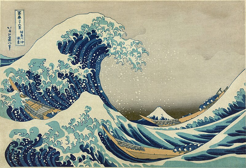
File:Great Wave off Kanagawa2.jpg
"The Great Wave Off Kanagawa" by Katsushika Hokusai, 1826-1833
The news is now filled with images and stories of the continuing destruction on Honshu, the most populous island in Japan. After a magnitude 8.9 earthquake that shifted the sea floor in the Western Pacific and displaced a huge quantity of water, a massive tsunami rolled over Japan's coast.The damage is immeasurable: billions of dollars, threats of a nuclear meltdown, and over1,600 lives confirmed lost.

More posts on this event will follow, but I want to take this moment to wish good luck to all those who are still searching for friends and family. We should also all hope that the major damage is done and that no more pain will be visited on the victims of the tsunami.

Stay safe.

Thursday, March 10, 2011

The Incredible Crater Collapse


(The collapse of the Puʻu ʻŌʻō Crater in Hawaii. Courtesy of the USGS)

Last night, I attended the 1449th Meeting of the Geological Society of Washington , which meets at the Cosmos Club- the intellectual society founded by John Wesley Powell, one-armed Civil War vet and geologist extraordinaire. Preceding the evening's lectures, Dr. Roz Helz of the USGS (ret.) and the (The Hawaiian Volcano Observatory) brought forth an "informal communication" before the group. Her presentation highlighted the video above, which was recorded on March 5th by the HVO's extensive video monitoring system on several major volcanoes and vents, from Mauna Loa (the most voluminos mountain in the world) to Kilauea (one of the most active volcanoes in the world.) This particular video shows the latter, specifically an outlet called the Puʻu ʻŌʻō Crater. The time-lapse video shows from 4 AM to 11 PM, where runny basaltic lava poured out and hardened on the crater floor, only to collapse 377 feet into a hellish looking pit. I would have loved to hear a bit more explanation about how this happened, but my guess is that the magma plume that was rising underneath the crater subsided quickly, either because of changing pressure and temperature in the Earth's crust, or because the magma was diverted elsewhere. The crust of dried lava on top appears to keep accumulating puddles of lava from smaller side vents until the weight is too great. It is impressive how much steam and gas escapes from the crater once the top is broken.

It is a great illustration of the liquidy, syrup-like lava of basaltic volcanoes with their low viscosity. (Hawaii's volcanoes are fed by basaltic magma, which is low in thickening silica, unlike a stratovolcano like Mt. St. Helens.) According to Hawaiian tradition, the name for the Puʻu ʻŌʻō crater derives from the word for "digging stick." It was apparently, Pele, the goddess of volcanoes, who created these structures using the tip of her giant staff. I think all of us in tectonically stable areas can be glad that she didn't walk over our homes.
Nature Blog Network